Postcodes
Any UK, Isle of Man or Channel Island address can be found in the Royal Mail database simply by using its postcode and house number/name. Such is the usefulness of postcodes that since 1996 it has not even been necessary to include the county in an address, though many still do. Postcodes were introduced nationwide from 1971 to 1974 and it seems remarkable today that we ever managed without them.
London was the first city to be divided into areas denoted by letters. Sir Roland Hill (1795-1879) devised a system in 1856 which used the points of the compass; hence, EC and WC for the City of London, and N, NE, E, SE, S, SW, W and NW for the rest, although NE (now Newcastle) and S (now Sheffield) were removed shortly afterwards. This was a boon to mail sorting offices and in 1917 Albert Illingworth (1865-1942) added numbers too.
Several other cities tried their own postcode schemes and with the advent of mechanised letter sorting in the 1960s it was decided to roll one out to the whole country. The most common format is AB12 3YZ, where AB is one of the 124 postal areas, the numbers narrow it down further and YZ is the precise neighbourhood.
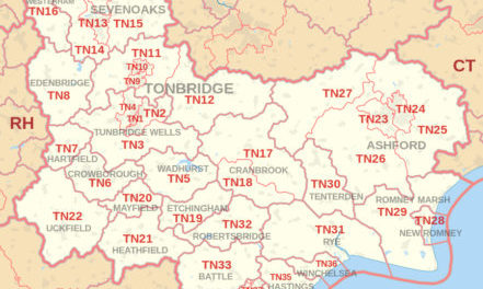
(Image of the Tonbridge postcode area [cropped]: Richardguk at Wikimedia Commons / CC BY-SA 3.0)
